*Note: Elements of this plan are updated as part of the 2021 VTrans Bicycle and Pedestrian Strategic Plan
On-Road Bicycle Plan Overview
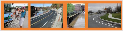
The overall goal of the On-Road Bicycle Plan is to improve the condition of state roads to enhance safety and better accommodate the needs of all bicyclists in support of enhancing on-road bicycle improvements on State roadways. The VTrans On-Road Bicycle Plan is a planning effort to categorize the state roads into high-, moderate- and low-use/priority corridors based on current and potential bicycle use. The Plan’s emphasis is on those roads designated as high-use priority bicycle corridors and will assist VTrans in understanding where to focus limited resources towards bicycle improvements and allow better integration into Agency projects and activities.
Plan Phase Overview
Plan Phase 1: DETERMINE USE on state roads using data and public input to create the VTrans Bicycle Corridor Priority Map. Priority corridors are state roads categorized into high-, moderate- and low-use based on current and potential bicycle use. Plan concluded in April 2016.
- VTrans On Road Bicycle Plan - Phase 1 Report
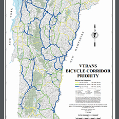
- VTrans Bicycle Corridor Priority Map. Bicycle use was quantified through analysis of land use patterns, bicycle access to state roads, proximity to destinations, data collected on recreational bicycling using StravaMetro data, and public input through the project’s interactive crowdsourcing map (aka WikiMap), in combination with a qualitative smoothing process using VTrans’ experience managing state roads.
- Response documents – December 2015, May 2015
- Public Meeting 1 – January 7, 2015 – Meeting Presentation and Webinar recording
- Public Meeting 2 – April 30, 2015 – Meeting Presentation and Webinar recording
- Public Meeting 3 – December 1, 2015 – Meeting Presentation and Webinar recording
- Frequently Asked Questions
Plan Phase 2: EVALUATE NEEDS by conducting a detailed bicycle crash analysis (on state roadways) and the developing a methodology to assess how comfortable state roads are to bicycle. Plan concluded in April 2018.
- VTrans On Road Bicycle Plan – Phase 2 Report
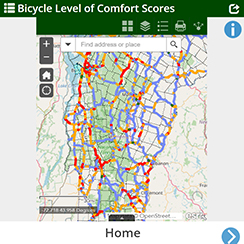 Bicycle Level of Comfort (BLOC) Map - Roadways are scored on a four-point scale relating to bicyclist confidence levels, from most comfortable (1) to least comfortable (4). The map is a planning tool intended to assist the Agency to better inform decision making during corridor planning, prioritizing bicycle improvements in projects and maintenance activities, and defining project scopes.
- Public meeting that focused on crash analysis
Next steps
In 2021 VTrans completed the VTrans Bicycle and Pedestrian Strategic Plan that was developed on the foundation of the On-Road Bicycle Plan Phases 1 and 2.