
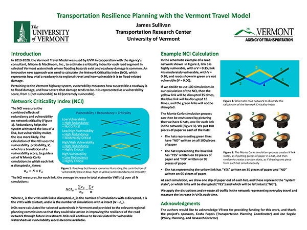
Brief Project Description: In 2019-2020, the Vermont Travel Model was used in cooperation with the Agency's consultant, Milone & MacBroom, Inc., to estimate a criticality index for each road segment in selected Vermont watersheds where flooding hazards exist and roadway damage is common. An innovative new approach was used to calculate the Network Criticality Index (NCI), which represents how vital a roadway is to regional travel and how vulnerable it is to flood-relate damage. NCIs were calculated for selected watersheds in Vermont and provided to the relevant regional planning commissions so that they could take action in improving the resilience of the road network through future investment.
Poster: [Click to enlarge]
Presentation: [Click image to display]
Fact Sheet Video Other Q&A
Related Report
Presenters: James Sullivan, University of Vermont
VTrans Champion: Joe Segale
Questions or comments about the Poster? Contact the researcher james.sullivan@uvm.edu. The researcher will assemble a Q and A document reflecting all queries received by 9 AM September 14th. The Q and A should be posted by September 15.