
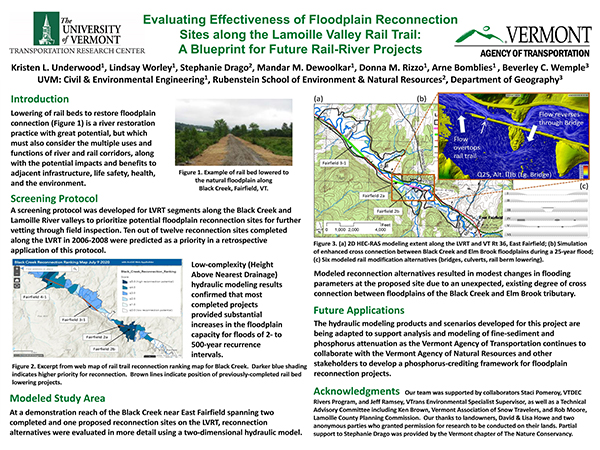
Brief Project Description: Former rail embankments can be modified to reconnect historically-isolated floodplains and increase floodwater and nutrient storage for reduced downstream impacts. Yet these restoration projects must consider the multiple uses and functions of river and rail corridors, along with the potential impacts and benefits to adjacent infrastructure and the environment. This research has generated a screening protocol for prioritization of potential floodplain reconnection sites along rail-banked recreation trails. Additionally, a two-dimensional hydraulic model has been developed for a demonstration site on the Black Creek to evaluate various floodplain reconnection alternatives.
Poster: [Click to enlarge]
Fact Sheet Video Black Creek Webmap Lamoille River Webmap Q&A
Related Report
Presenters: Kristen Underwood, University of Vermont
Champions and TAC Members: Jeff Ramsey, Staci Pomeroy (ANR-DEC), Joel Perrigo, Mark Fitzgerald
Questions or comments about the Poster? Contact the researcher kristen.underwood@uvm.edu. The researcher will assemble a Q and A document reflecting all queries received by 9 AM September 14th. The Q and A should be posted by September 15.