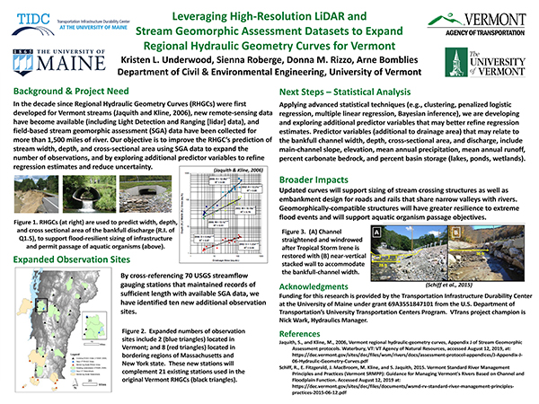
Brief Project Description: Regional hydraulic geometry curves (RHGCs) for Vermont are being updated through development of additional observations and use of newly-available high-resolution lidar and stream geomorphic assessment data to improve the prediction ability and reduce estimation uncertainty using RHGCs. Updated curves will support sizing of stream crossing structures as well as embankment design for roads and rails that share narrow valleys with rivers. Geomorphically-compatible structures will have greater resilience to extreme flood events and support aquatic organism passage objectives.
Poster: [Click to enlarge]
Fact Sheet Video Other Q&A
Related Report
Presenters: Kristen Underwood, University of Vermont
VTrans Champion: Nick Wark
Questions or comments about the Poster? Contact the researcher kristen.underwood@uvm.edu. The researcher will assemble a Q and A document reflecting all queries received by 9 AM September 14th. The Q and A should be posted by September 15.